

Its Evening,mostly clear and it feels Extremely hot outside. The temperature has been falling for the last few hours. There is a Calm from the North east
Today Sunny and very hot. highs 110 to 115. south wind 5 to 10 mph in the morning becoming west 5 to 15 mph in the afternoon. Sun Rise at , Sun Set at .
Today Sunny and very hot. highs 110 to 115. south wind 5 to 10 mph in the morning becoming west 5 to 15 mph in the afternoon. Sun Rise at , Sun Set at .
Date
, , Evening
Week: 32 of 52
last update: , next update:
Week: 32 of 52
last update: , next update:
Weather conditions
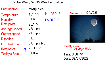
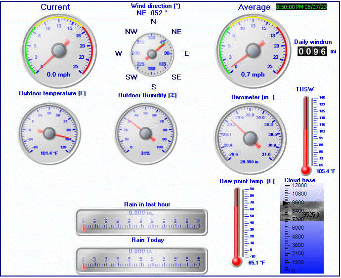
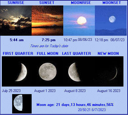
Good Evening, from Cactus Wren Neighborhood weather station at 8:50 PM, Monday, August, 07, 2023. The forecast is Today Sunny and very hot. highs 110 to 115. south wind 5 to 10 mph in the morning becoming west 5 to 15 mph in the afternoon. , NO CURRENT ADVISORIES. Current Conditions, Dry, Its Evening,mostly clear and it feels Extremely hot outside. The temperature has been falling for the last few hours. There is a Calm from the North east, temperature 102 degrees fahrenheit, humidity 31%, Dew Point 65, Barometer: 29.390 Inches of Mercury, trend Rising slowly, whind North east at 1 miles per hour, gusting to 2 miles per hour, Ultra Violet level 0.0 U V, Solar level 0 watts per meter squared, 0.00 inches of rain today, sun rise at 5:44 am, sun set at 7:25 pm. Moon Rise at 10:47 pm, current Moon phase Waning Gibbous Moon, Moon sets at 12:18 pm. The next update follows in 30 minutes, thank you for visiting Cactus Wren, Scott's Weather Station.
NO CURRENT ADVISORIES
The temperature is Extremely hot
Dry, mostly clear, Cooling
The temperature is Extremely hot
Dry, mostly clear, Cooling
Temperature
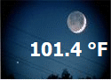
Now: 101.4°F-1.5
Now: 38.6°C
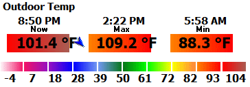
High: 109.2°F @ 2:22 PM
Low: 88.3°F @ 5:58 AM
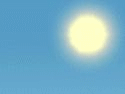
Sun Shine conditions
Feels like: 105°F THSW: 105.5 °F, MDI: 88.3
Apparent Temperature in the sun: 106.6°F
Time ( Minutes) to burn (normal skin): 720
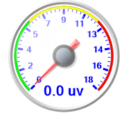
UV Index: 0.0 UV Index high: 4.8
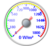
Solar Radiation: 0 W/sqm
Solar Radiation High: 963 W/sqm
Apparent Temperature in the sun: 106.6°F
Time ( Minutes) to burn (normal skin): 720
UV Index: 0.0 UV Index high: 4.8
Solar Radiation: 0 W/sqm
Solar Radiation High: 963 W/sqm
Humidity
Current: 31%
High: 53% @ 6:13 AM
Low: 24% @ 2:19 PM
Dew point: 65.1%°F
Humidty Index: 112.8°F

High: 53% @ 6:13 AM
Low: 24% @ 2:19 PM
Dew point: 65.1%°F
Humidty Index: 112.8°F
Pressure
Current: 29.390 inHg +0.015 Rising slowly
99.5 kPa, 995.3 mb
High: 29.564 inHg @ 9:17 AM
Low: 29.367 inHg @ 7:03 PM

99.5 kPa, 995.3 mb
High: 29.564 inHg @ 9:17 AM
Low: 29.367 inHg @ 7:03 PM
Wind
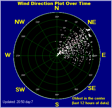
Current: 0.6 Mph 50° NE, 2.0 Gust Mph
average: 0.6 Mph NE
Gust: 2.0 Mph NE
Max: 20.0 Mph ESE
Max gust last hour: 9.0 mph NE Mph Time: 7:58 PM
Max gust to day: 20.0 Mph
average: 0.6 Mph NE
Gust: 2.0 Mph NE
Max: 20.0 Mph ESE
Max gust last hour: 9.0 mph NE Mph Time: 7:58 PM
Max gust to day: 20.0 Mph
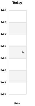
Rain
Today 0.00 Inches @ -
Current rain episode duration Minutes: 0 Rate pre Hour: 0.000 for day: 0.000
Yesterday: 0.00 Inches
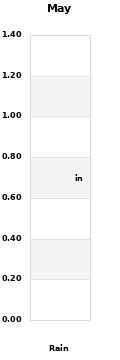
Month: 0.00 Inches
Average difference for Month: ---.
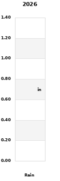
Year: 3.16 Inches
Consecutive days with no rain: 6
Days with rain for the year: 16


Current rain episode duration Minutes: 0 Rate pre Hour: 0.000 for day: 0.000
Yesterday: 0.00 Inches
Month: 0.00 Inches
Average difference for Month: ---.
Year: 3.16 Inches
Consecutive days with no rain: 6
Days with rain for the year: 16
Sky Harbor METAR Weather Conditions

,
Weather Report: mostly clear, Visibility: 10 mile(s)
Temperature: 106.0 F , 41.1 C, Dew Point: 59.0 F ,
Wind: WSW (250 degrees) at 9 MPH (8 KT):),
Rain last Hour: ---
Barometer reading: 29.82 in. Hg (1009 hPa)
National Weather Service 5 Day Forecast
NWS Forecast:

TONIGHT

MONDAY

MONDAY NIGHT
INDEPENDENCE DAY

TUESDAY NIGHT

WEDNESDAY

WEDNESDAY NIGHT

THURSDAY
Astronomical Data
Sun
Rise:
Set:
Hours of day light: 13:41
Change in day: -00:01:40
Next Solar Eclipse: April 08 2024 11:23:01 69%
Set:
Hours of day light: 13:41
Change in day: -00:01:40
Next Solar Eclipse: April 08 2024 11:23:01 69%
| Solar X-Rays: |
|
| Geomagnetic Field: |
|
| from n3kl.org | |
Moon

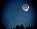
Waning Gibbous Moon 56%
Moon age: 21 days,13 hours,46 minutes,56%
Rise:
Set:
New Moon:
First Quarter:
Full Moon:
Last Quarter:
Next Lunar Eclipse:
Moon age: 21 days,13 hours,46 minutes,56%
Rise:
Set:
New Moon:
First Quarter:
Full Moon:
Last Quarter:
Next Lunar Eclipse:

